Leg 3 – South America (+/- 4,000 km)
Countries: Bolivia, Argentina, Chile
When I travel there are always those little country gems that I tuck away and save for a special time somewhere in the future. For me, Bolivia, Argentina and Chile are the little gems that I have always avoided as I wanted to save them for a special occasion; rather than see them from a bus window with my wife. I wanted to selfishly keep them until I had the time to properly appreciate them from the saddle. This time was now, and so when I arrived in South America I flew into La Paz, Bolivia where I cycled south with my final destination being Santiago in Chile.
I gave myself 3 months in South America and given the enormous size of the continent this realistically meant that I was going to have to concentrate my route within the southern countries of Argentina, Chile, and Bolivia.
The interactive map below outlines the route that I took as I set out cycling from La Paz to Santiago.
The blue route line is often not the actual route that I cycled, more a representation. For the actual GPS tracks that I rode each day please scroll down and click on the Actual GPS links at the bottom of this page.
Please click on the map symbols for more detail about each leg, and zoom in for a closer view of the route that I cycled through South America.
(the initial map load time may be slow depending on your internet connection)
Zoom in on the map for a closer view of my route
My initial plan when I left La Paz was to head south on the highway for 100km before turning west towards Sajama National Park which lies on the border with Chile. From there, I cycled completely off road through the Altiplano towards the Salars of Uyuni. Thankfully, the worst of the rainy season were late arriving otherwise I wouldn’t have been able to ford my way across the ‘un-bridged’ rivers of the Bolivian Altiplano.
I managed to cross most of the salt encrusted Salar of Coipasa by bike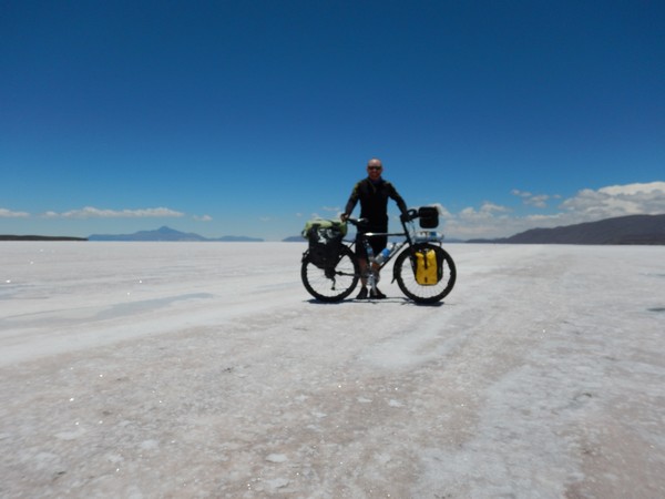 But as I reached the southern end the salt crushed was wet
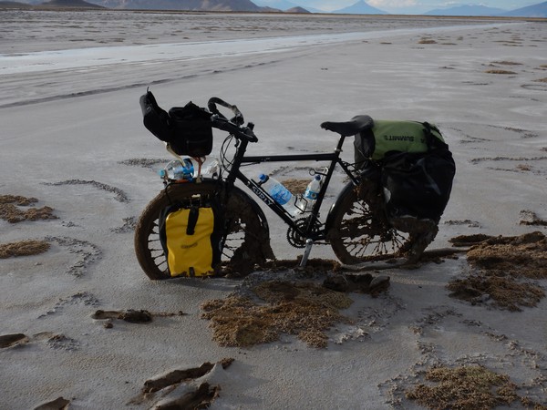 and I was soon bogged down (it took me a couple of hours to carry/push/pull my bike the final kilometer to solid land.
Once I reached the Salar of Uyuni they were partially underwater and so I had to take a bus across 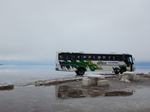 These are the world’s largest salt flats. They sit at a lofty 3600m and blanket an amazing 12,000 sq km of south western Bolivia.
This unique landscape was formed from the prehistoric Lago Minchín, which once covered most of southwest Bolivia. When it dried up, it left several salt pans, including the famous Salar de Uyuni. The amazing beauty of this vast salt desert makes it one of South America’s most awe-inspiring destinations.
From the Salars I continued cycling south towards Villazon and the border with Argentina. Once I reached the frontier it was time to descend off the Puna and head towards the wine regions of Cafayate and Mendoza. I followed the same plan that I had in New Zealand – I tried to stick to ‘off road’ sections as much as possible and then used Highway 40 in Argentina to take me down to Mendoza, before crossing the Andes Mountains towards Santiago in Chile.
 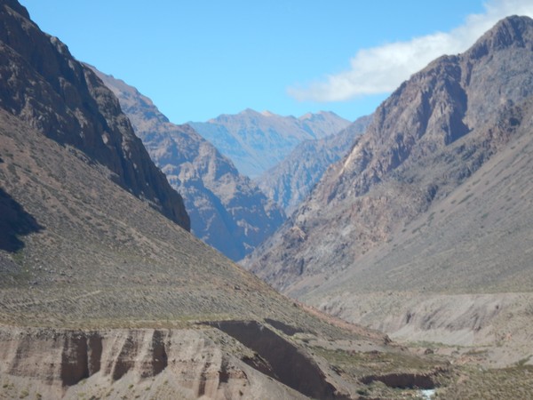 Given the mountainous terrain of the Andes Mountains and the Bolivian Altiplano the majority of the cycling in Bolivia and northern Argentina was at an elevation in excess of 4000m, which was an amazing test my stamina !!!!
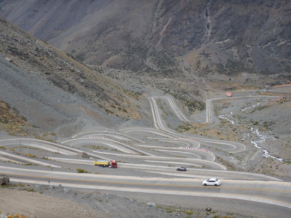 As I outlined above, in a way this is the leg of the journey was the one that I was most looking forward to – living in my tent, waking each morning to silence (except when staying at an official Argentinian campsite – be warned !!!!) with spectacular scenery all around.
The other major factor, apart from elevation, that affected the distance I was able to cover was every cyclists worst nightmare – wind. This part of the South American continent is renowned for a westerly wind. For most of the year, cycling from Boilivia south you can expect a headwind and then from Santiago to the Carretera Austral a tailwind. of about 15 – 20 km/h. Once you hit Patagonia in the summer months however, winds pick up and they can even reach speeds of about 120 km/h. It just so happens that I saved Patagonia for another trip !!!!.
The following is taken from a National Geographic article by Simon Worrall:
The wind chased me everywhere I went in South America. It clogged my sinuses and sent the Jeep slithering across the gravel roads as though on ice. Birds flew backward. Trees grew horizontally. The wind was a living thing. It could be violent, punching holes in glass windows or sending spirals of dust rising above the flat, dry steppe like miniature tornadoes. On a plateau above the Santa Cruz River Valley I got out of the Jeep to take a photograph, and a blast of wind wrenched the door out of my hand, bending it backward with such violence that it sheared off the two welded brackets holding the door to the chassis.
If you have any questions about my cycle through South America I would love to hear from you – please click here to email me direct!
Thanks for taking the time to read about my route through South America and the final mention must go to the innumerable people who helped me out along the way. I would just like to say a huge heartfelt thank you as without you my journey and memories would not have been the same.
Click on the links below to see my actual GPS route tracks through Bolivia, Argentina and Chile:
To see all of my GPS tracks through Chile – CLICK HERE
To see all of my GPS tracks through Argentina – CLICK HERE
To see all of my GPS tracks through Bolivia – CLICK HERE