 After spending a fabulous week cycling the south coast it was time to head north towards Mount Cook. Ahead of me lay nearly 500 km and 4 mountain ranges. The easy route was to go around them but that would be no fun.
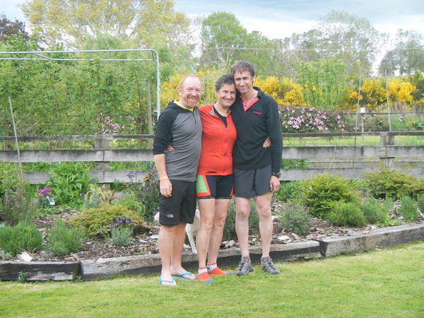
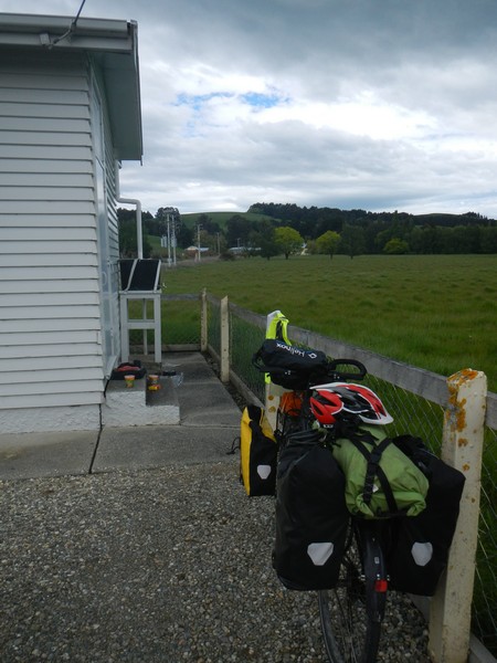
As I waved goodbye to the Sea Lions on the beach my destination that night was Pukerau. I had the offer of a bed for a few nights from Sue and Derek who are themselves both keen tour cyclists and lived around 100km north of where I had camped in Purakaunui Bay.
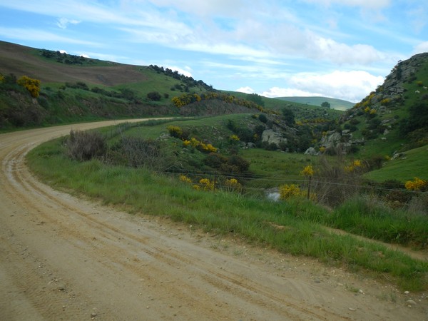
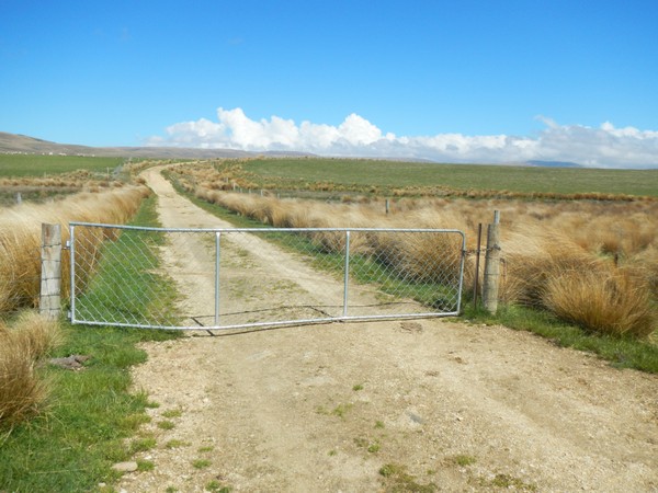
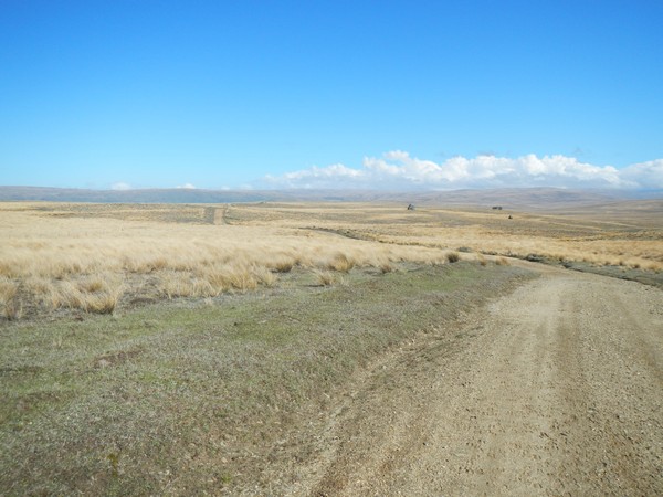
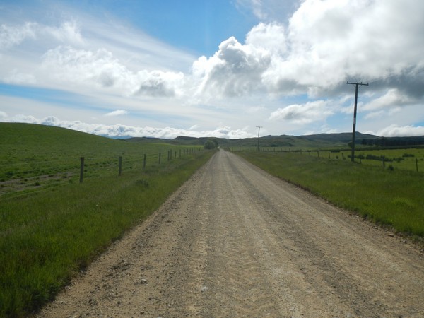
The first job of the day was to cycle back up the steep gravel track that I had rolled down the previous night.
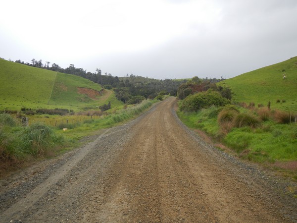
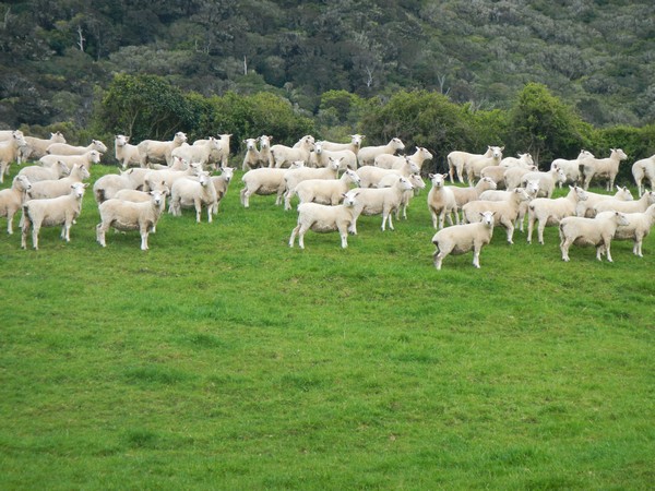
The track was still wet from the overnight rain that we had had and so was the steep sections were very slippery to ride up and the sheep had come over to see if I fell off.
Once over the hill I joined a tar-sealed road (this is a New Zealand expression for a surfaced road) that would take me the 15km to the town of Owaka where I would stop for lunch.
On the way I passed Lake Catlin
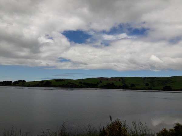
Although it is signposted as a lake it is not really a lake but a saltwater tidal estuary which is connected to the sea 7 kilometres away. At low tide it is only the very narrow Catlin’s River which holds water which then overflows its banks as the tide rises. As I cycled through at high tide my view was of a ‘lake’.
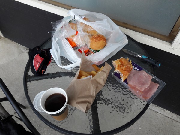
I had spent most of the morning chasing Sea Lions it was lunchtime by the time I arrived in Owaka. My first stop was at the 4 Square supermarket to buy some cheese topped rolls and ham and then went in search of a chip shop to buy some chips. One of the locals told me that the chipper wasn’t open on a Saturday lunchtime but that the local café would be able to rustle me up a portion which they did. I even ordered a 4 NZD coffee as it would have been slightly rude to have brewed my own.
As the sun had now come out I sat outside in the car park and made myself chip and ham butties. They tasted soooo good and maybe a new favourite when I am passing through towns at lunchtime.
I was halfway through eating my lunch when the owner drove into the car park and told me that I couldn’t sit there and eat my own food. I said that I had bought the coffee and chips from the café but she was not having a bean of it and told me that as I had bought them as takeaway (they were served in a wrapper rather than on a plate) that I would have to go and eat them elsewhere.
I’m not sure what her issue was but she definitely was not in a good mood that day. Rather than cause a fuss I ate the few remaining chips and packed away the bread and ham for later and carried on cycling.
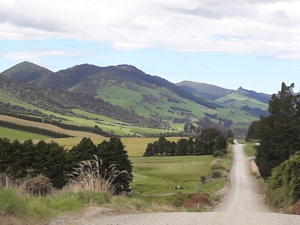
As I was leaving Owaka I stopped at the petrol station to ask for some advice on routing as I had two options – the first was to stay on the main road or the second was to cycle through Owaka Valley and over a saddle towards Clinton. The guy at the petrol station told me that although there was a 15km section of gravel that it was in good condition and so I opted for the climb through the valley road.
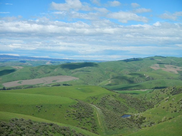
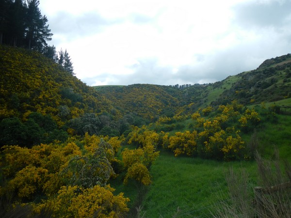
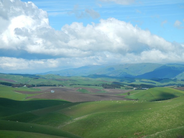
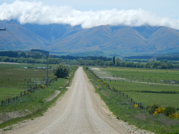
I was so glad that I had chosen this route as the cycle down the valley was among some of the most picturesque countryside that I had seen so far.
After 20 km the valley sides narrowed and it was time to climb up and over the saddle. For the most part the climb was not very steep but it went on for around 5km.
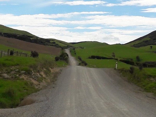
This section of the track was gravel but at the point that I climbed over the saddle they had tar sealed a kilometer section. The gradient here was very steep and for the first time on this trip I was cycling up the road in an S pattern. This is where instead of cycling straight up the road you cycle while swerving from either side of the road to try and reduce the gradient. I’m just glad that the steep climb to the saddle was fairly short.
Once I was over the saddle there was a gentle downhill section where I could roll and enjoy the scenery around me.
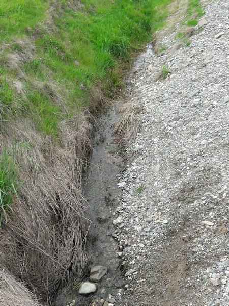
It had been a couple of hours since I had left Owaka and as I had forgot to fill up my water bottle I was now out of water. As there were no houses in this section of the valley I filled up from a stream next to the side of the road.
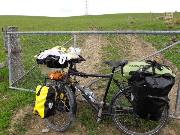
I ride with a Travel Tap water bottle which has a UV filter and so I can safely drink from any water source.
The one concern though is that at present New Zealand seems to be on a course where they are trying to wipe out non indigenous plants and wildlife from the country, and the way that they have chosen to do this is by dropping a pesticide called Sodium Monofluoroacetate all over the countryside. If you google 1080 (the common name for the chemical) and New Zealand you will see the controversy that this is causing in the country. Here is a newspaper article which explains a bit about it – The 1080 poison debate: What, why, how and associated risks
New Zealands claim to be clean, pure and green is definitely up for question and I can tell you that every day I cycle past around 50 dead birds by the side of the road. The birds look like there is nothing wrong with them and so I think that it is poison which is killing them rather than being hit by traffic.
The fact that New Zealanders are indiscriminately aerial dropping Sodium Monofluoroacetate means that it will of course get into the waterways which is my only reservation to drinking water from streams as my UV filter will not destroy the poison. Hopefully, my limited exposure should not cause any long term damage but it is the locals who drink from groundwater supplies that will be at more risk.
I took the opportunity of my water stop to finish my ham rolls that I had been in the middle of earlier and with my handlebar bag as my lunch table I sat enjoying the view of the valley around me.
Once lunch was finished it was time to get to Sue and Derek’s house as I said that I would be there between 6 and 7pm and still had another 50km to pedal. I was now back on tar sealed roads which meant that I just under 3 hours of cycling ahead of me.
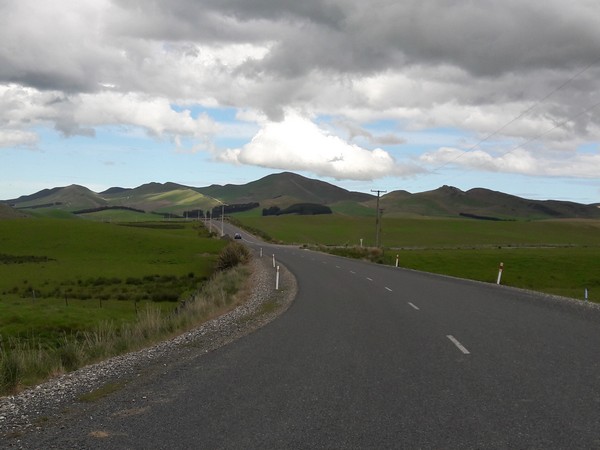
At the end of the valley that I was cycling through I came to a T-junction and a quick look at the sky showed me that it was raining in the valley away to my left but not to my right. A quick check of the map showed that both roads would eventually lead me to Pukerau and the distances were about the same so I chose this road.
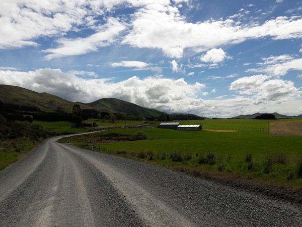
The farming in this part of the country seemed to have moved away from pasture farming to arable as the fields around me were full of crops and the bright yellow looked amazing against the dark skies away to my left.
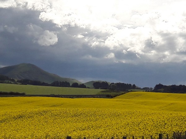
I think that I had definitely chosen the correct valley to cycle through as I could see the rain falling in the valley that I would have been cycling through had I turned left back at the last T- junction.
It was now nearly 6pm and should still have been bright daylight but as the storm that had developed away to my left rolled over day literally turned to night.
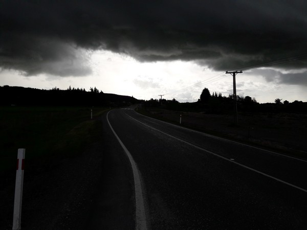
It really did get dark around me and I have not altered the picture above; even though it looks like it was shot in black and white it was actually taken in colour. The sound of thunder could be heard all around me and echoed off the rolling hills. 15 minutes before I had been cycling through sunshine and now there was this huge storm overhead. I was following a train line and up ahead I could see a train station in the village of Waipahi. As I pulled into the station to take shelter the heavens opened and the rain was bouncing all around me. As it looked like I could be here for a while I got the cooker out and brewed a coffee.
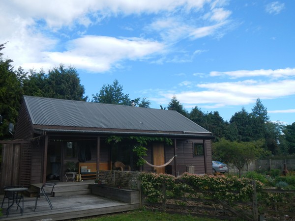
Once the worst of the rain had passed I got back on the bike and cycled the last few kilometers to Sue and Derek’s house. Their house is a converted sheep shearing shed, although from the inside you wouldn’t know it.
Sue is a world champion cyclist who has won many events in New Zealand and even the Masters World Road Race Championship. Even though Sue is still a keen road cyclist she has now moved her focus towards mountain biking as she prepares for her next big event – a 30 day race from the top of the North Island to the tip of the South Island – The tour Aotearoa
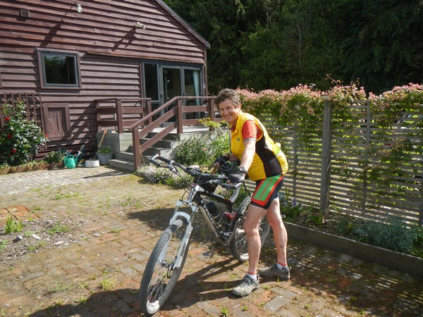
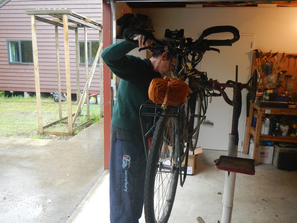
Derek used to own and run a bike shop and so gave my bike a 6000 km service which got rid of the squeaks that were starting to develop.
I spent a great three nights staying with them and they were able to give me lots of route advice on my cycle over the mountains towards Mount Cook as they had cycled much of this route a few years ago.
After three nights of luxury it was time to say goodbye and get back on the road. In front of me was a week of mountain passes but I was not expecting the climbing to start that day as that evening my plan was to get to Millers Flat which was just after Boa Flat, so I was expecting an easy day on the bike.
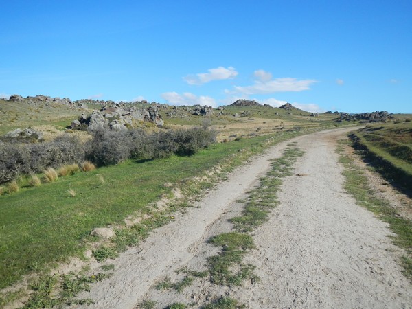
As I headed up the gravel track away from Pukerau I was met with the sight of bee hives in the fields next to the road.
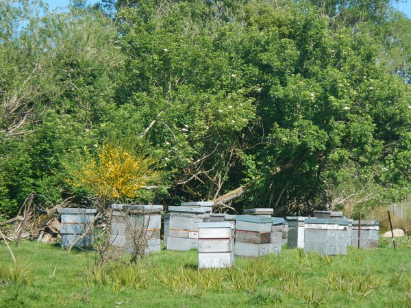
This meant that it must be fairly warm and as I continued up the track the sun came out and the layers of clothes came off. It was a beautiful track and on either side there were patches of yellow gorse.
After 10km the gravel track ended and as I came to the village of Waikoikoi it joined highway 90. I had the choice of staying on the main road or heading along the side roads towards Kelso. The main road was shorter but as I was stood deciding two milk tankers roared past at 100kmph and so my mind was made up, the longer side road it would be.
I could see away to my right a hill but I wasn’t sure if I would need to cross it or not.
As I was heading for places with ‘flat’ in their names I hoped not.
I passed through Kelso and as I had not taken the main road earlier I decided that I would stay on the side roads and so headed to a strange little village called Heriot which seemed to just sell farm machinery and had lots of truck haulage businesses.
It was here that the hills started and although the road was never that steep it always kept climbing. I wanted to wait until I had finished climbing to have lunch and thankfully after about 10km the road dropped steeply into a valley.
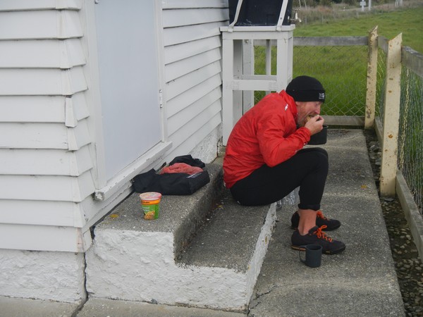
I found a house which had a tap on the outside and looked like nobody lived there so took advantage and sat on the back step to have lunch.
After lunch I was once again climbing and thought that it must surely end soon as I was now on Moa Flat Road which seemed to be the summit of a hill rather than what I had been expecting. So much for my easy first day back on the bike.
At the summit I came to a T-junction and from there I could see something that I had not seen from a few weeks – snow on the tops of the hills.
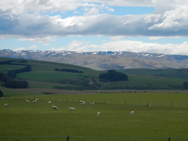
I took the right turn and it was then payback time for the last 3 hours of climbing as the road started to descend. The other advantage of climbing is the stunning views that you get and as the sun was shining I could see for miles
There was one final really steep descent that took me through a valley and back the main highway at Ettrick.
That day I had climbed the best part of 900m and was not expecting to be up on a mountain until the following day. So much for Moa Flat Road being flat.
Here is a 2 minute video which will show you the kind of countryside I was cycling through as I crossed Moa Flat.
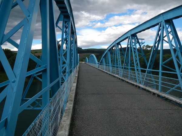
Next to the main road in Ettrick was the Clutha River and the track that I needed was on the other side of the river.
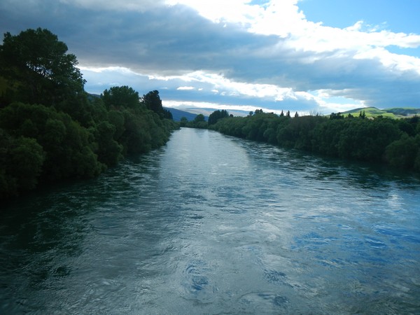
The river was dammed further upstream and they were obviously releasing water that day as the river was flowing that fast it looked like it was in spate. There was no way that I would be fording my way across it. Instead, I continued on the main road the final 10km that would take me to a bridge at Millers Flat, which thankfully was flat.
I knew that there was a campsite there where I could get a hot meal and a shower. As I pulled in I saw a lady lay on the grass reading a book and parked next to her was a bike. I thought that after 3 weeks I had finally managed to catch up with another cyclist.
The campsite lay on the Clutha Gold cycle track that is part of the National Cycle Network and the lady had cycled 30km up the track with her husband. He had cycled back to get their campervan while she waited reading a book. I suppose that technically this counts as my first cyclist.
When I registered the lady said that there was wifi at the office but not in the rest of the campsite. As the sun was shining I got my chair off my bike and sat on the lawn for a couple of hours catching up with the world. It was just so nice to be able to sit outside in the sunshine.
Around 6pm I packed up the chair and cycled to find somewhere to pitch my tent. As there was nobody else camping there that night I literally had the place to myself.
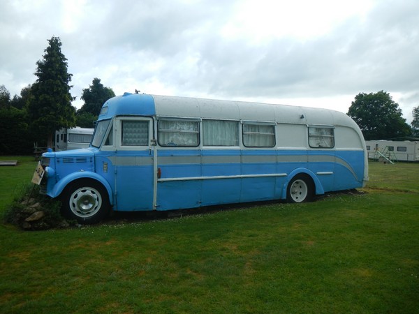
In the campsite there were a number of camper vans and buses for sale and some of them were pretty ancient and I think would be a great fun to drive around New Zealand.
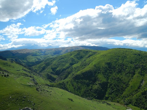
The climbs that day had come as a surprise but I knew that the following day would be tough and expected to be climbing close to 2000 m as the track that I would be following would take me over the summit of Mount Teviot.
The brilliant sunshine that I was looking forward to the next morning never materialised and as I got up drizzly rain was falling. This put a dent into my morning but by the time I had had a shower and breakfast at least the rain had stopped.
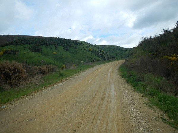
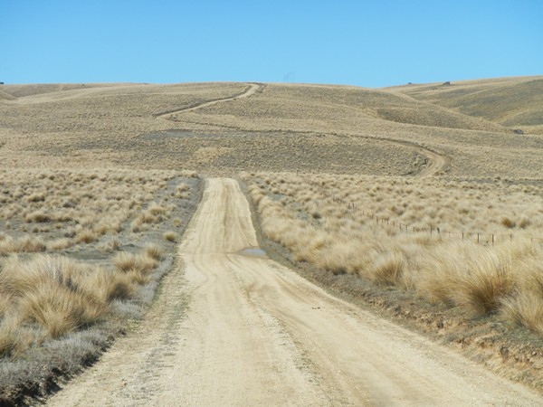
I set off knowing that I would be spend the best part of the morning climbing Mount Taviot and after only 2km the climbing started as I turned onto the track that was signed Lake Onslow.
The track was in very good condition and was more sandy than stoney gravel. The rain that had fallen in the night meant that cycling down the track was like cycling through porridge as the wheels bogged down and the track seemed to glue itself to the wheels.
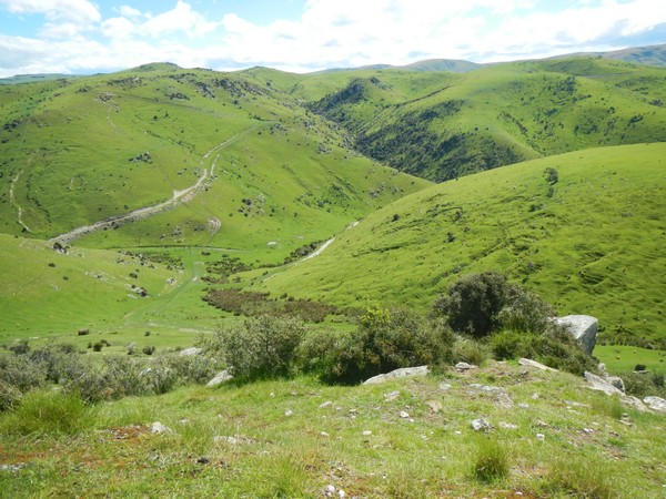
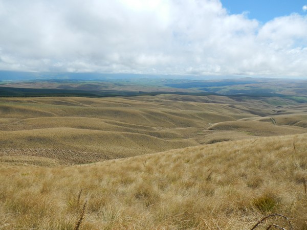
All of this combined to make the first few hours hard work and it was only the views which kept me sane.
As I climbed higher the sun finally made an appearance and the layers of clothes could start to come off. Like yesterday, once I had reached over 600m the valley in front of me opened up and I was cycling along a ridge line which took me over the tops of the hills.
The morning sun had even dried out the track and on the downhill sections I was now rolling along
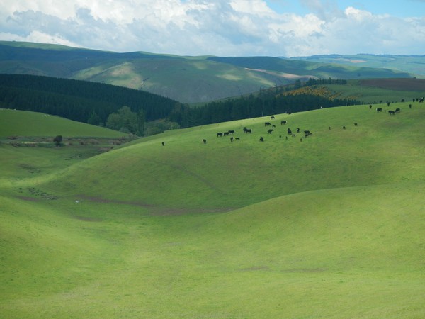
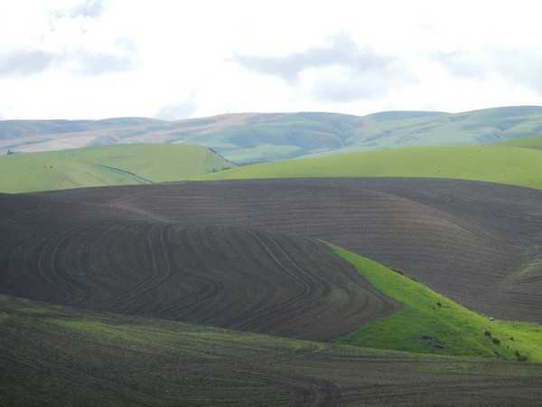
The land around me was still farmed as sheep and cow pasture which meant that the farmers had to plant grass in the fields. The fields which had been freshly ploughed looked like pieces of art against the bright green
I was now up at 800m and the views back down the valley were beautiful and the track was a dream to cycle on.
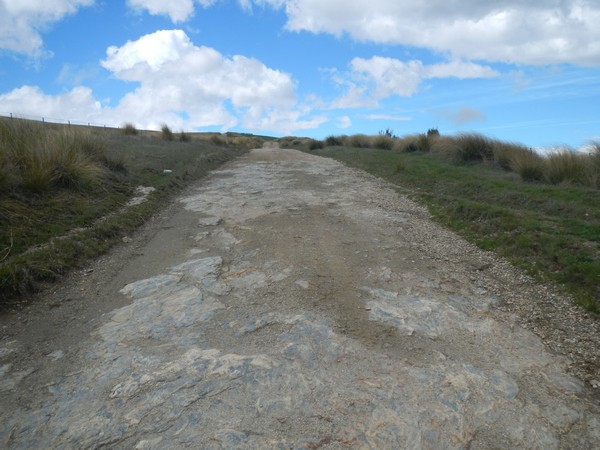
I came to a fork in the road and I from a quick check of the map I knew that Mount Teviot was away to my right. There was a warning sign which said that this track was only to be driven in dry weather and once I was a couple of kilometers down it I could see why as the surface of the track rapidly deteriorated.
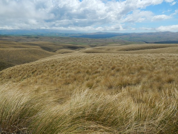
I had now climbed to over 900 m and the landscape completely changed as the lush green grass that farmers planted further down the valley was replaced by the more natural mountain grasses which grew at this altitude.
I could see the track on front of me as it zig zagged its was up to the summit of Mount Teviot
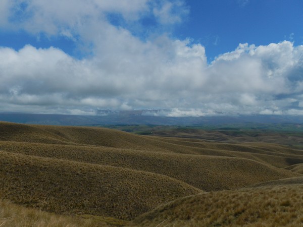
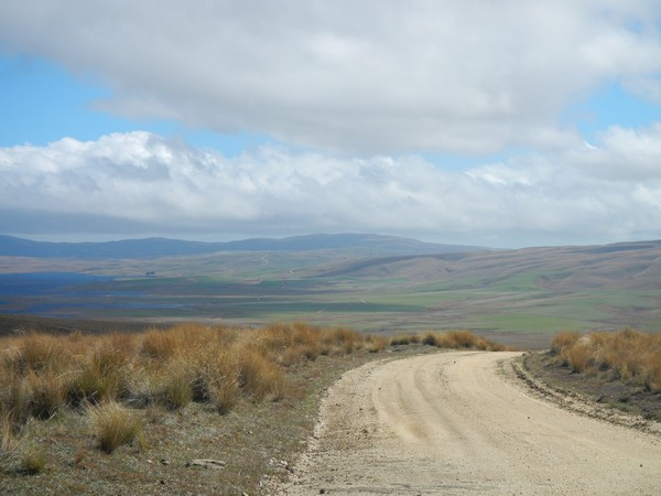
Once I had cycled to the summit the view from the top back down the valley was pretty special
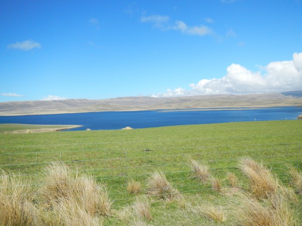
It had taken me more than 3 hours to reach the summit of the mountain and I was ready for lunch. The wind was blowing fairly hard so I decided to drop down a few hundred meters and when I crested the summit I could see Lake Onslow away in the distance and decided that would be as good a place as any to stop for lunch.
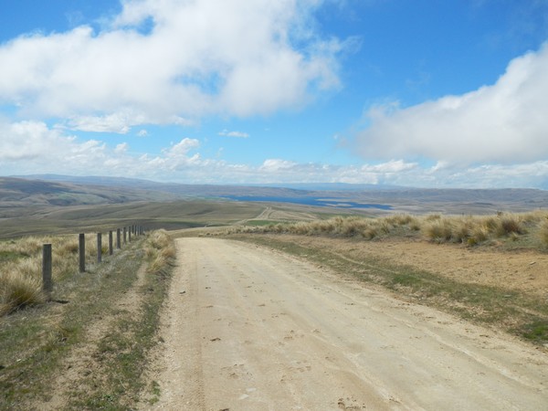
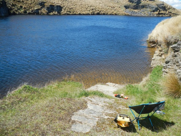
I found a nice sheltered spot next to the lake and sat and had a pot noodle lunch
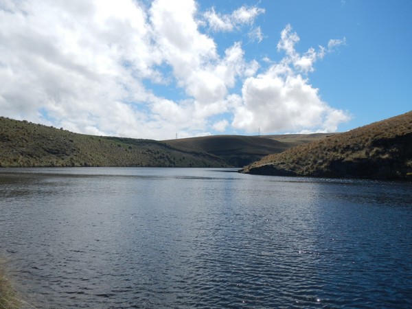
A quick check of the map showed me that I would need to cycle around the lake as the track that I needed was at the far end. It looked like there was a dam that I would need to cross and when I resumed cycling after lunch I soon came to it.
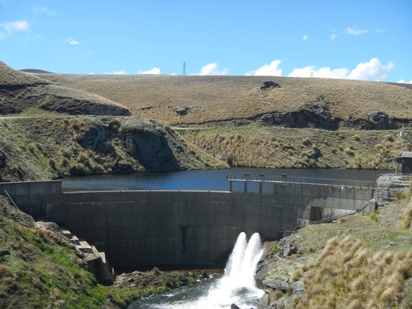
Water was being released and ran into stream which snaked its way down the valley through a gorge area.
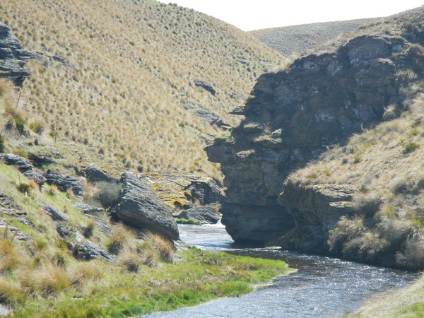
There was no way across the dam as wire fencing blocked the way so I followed the stream for a few hundred meters until I came to a place where I could ford the river.
Once on the other side of the stream there was a steep climb back to the shore of the lake and then I followed the shoreline.
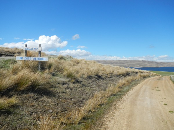
At the far end of the lake the track rose steeply until I came to a sign which said – Snow line and no dogs allowed.
The road split here with one track climbing higher and the other track winding its way around the hillside. I checked the map and it looked like both roads would meet up again in around 5km so took the track which went around the side of the hill.
After a kilometer or so I came to a set of gates which were shut but not locked and went through them. All along this track there were about 5 gates but none of them were locked.
I could now see the track which had gone over the top of the hill descending to meet mine and after another 2 km they merged.
I was heading towards Paerau and a look to my right showed me that I would once again have to climb my way out of the bowl that the lake sat in
The climb out was steeper than it looked and I was glad after 40 minutes when I reached the top and looked back.
I was now on the saddle and I knew that this would be my last climb of the day.
On the other side of the saddle the road descended which was a nice feeling knowing that I could just roll as I had climbed nearly somewhere in the region of 1800m. As I followed the track downhill towards Paerau I cycled through what I can only describe as a rock debris field.
There were large chunks of rock places randomly all over the landscape. I have no idea how they got there but they did seem out of place.
It was now past 6pm and I needed to find somewhere to camp for the night. I did not want to sleep up on the saddle just in case the weather took a turn for the worst and so waited until I had descended to the valley floor below.
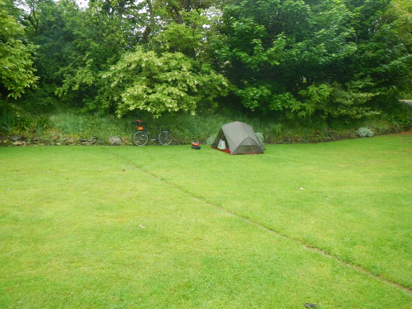
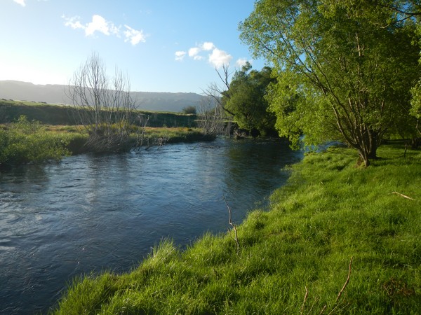
Once I was safely in the valley I stopped at the first river that I passed and cycled down the farm track which ran parallel with the river. The field that I was cycling through was a sheep field and I cycled about 500m down it towards a clump of willow trees.
If there had been a farmhouse nearby I would have asked for permission first but as there was not I couldn’t. In New Zealand they have cracked down on freedom camping but technically you can still legally camp on the sides of rivers. The laws of the land mean that even if a river passes across private land on most rivers there still has to be legal access for fishermen. I would use this as my defence on the slight chance of the farmer turning up and ranting at me about being on his land.
As I arrived the rivers edge the sun was still shining as it had not quite descended over the mountain range that I had just crossed and I knew that I still had about an hour of daylight left to have a wash and eat dinner.
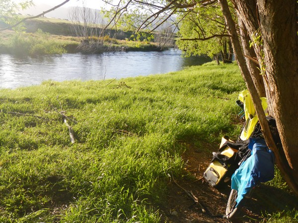
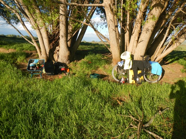
I found a flattish area to pitch my tent and cleared it of sticks and stones. I waited until the sun was just about to set before putting it up just in case the farmer came down to check on his sheep which were in the field that I was camped in.
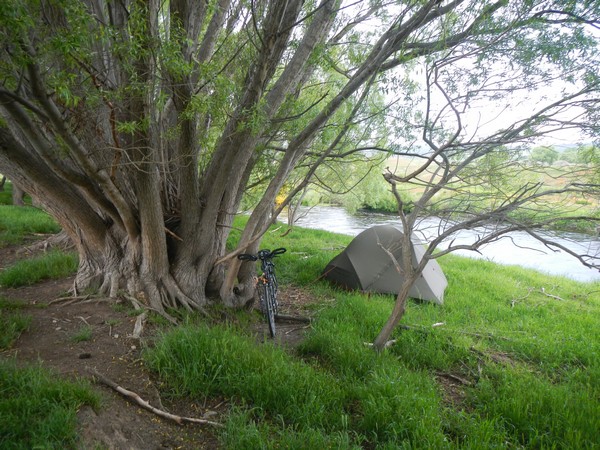
Luckily he never and that night I slept with the sound of the river running by my tent and had a greats night sleep.
Here is a video of my cycle that day over Mount Teviot and through Lake Onslow
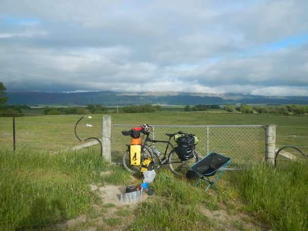
The one downside to camping on a farmers land without permission is that you need to be up early to get packed up and away before the day really got going and so by 7am I was back on the bike and heading across the valley in front of me.
To save time I had packed before having breakfast and so after 5km I pulled over into the gateway of a field to eat.
After a long day on the bike yesterday today was going to be much easier and when I set off again after breakfast my planned destination was a town called Naseby which lay around 35km away across a flat valley.
My legs were sore from the climbing that I had done to get over Mount Teviot but my hamstrings seemed to have sorted themselves out which I was really happy about. When I start cycling after a hard day it normally takes the first hour to get everything warmed up and so the first 15km or so are always the worst. Once that first hour is up then everything seems to fall into place and all of the aches and pains drift away.
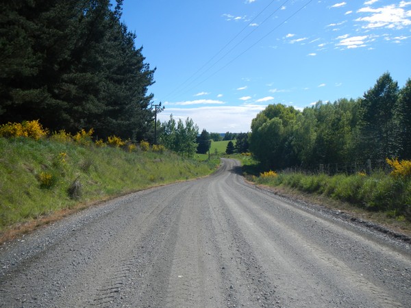
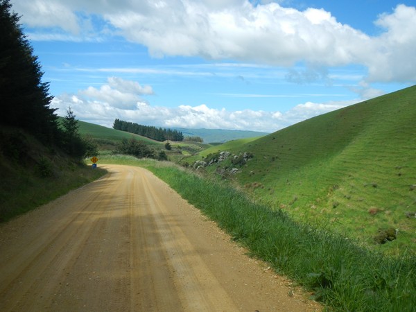
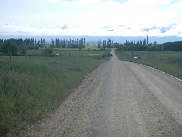
The most direct route to Naseby is to take the main road to a town called Ranfurly and then onto Naseby. As you may have guessed by now if there is another option, even though it may be longer, I tend to take that and that day was no different. Instead of staying on the main road I checked the ma and there was a gravel road which would take me to a village called Waipiata and from there I could stay off road all the way until Naseby.
I arrived at Waipiata around 10.30 and as I had had a really early start I was ready for lunch. There was a pub in the village and I called in as I wanted to see who had won the US presedential election as I had had no phone signal since leaving Millers Flat the day before.
When I walked into the pub they had CNN on and bugger me the idiots in America had voted trump in. The landlord said that it had been a landslide for Trump in terms of seats but that Clinton had won the popular vote. Maybe it was time to see about a permanent residency in New Zealand as I’m not sure the world is a safe place with Trump in charge.
The landlord said that they hadn’t started serving food yet but he could rustle up me a chicken snitzel which sounded good. I was tempted to have a beer with it but opted for coffee instead. This seems to be another pattern that I have gotten into – if I freedom camp the night before I tend to treat myself to a cooked lunch the following day as a kind of reward.
The landlord asked me which way I was cycling so I told him and he seemed surprised as he thought that I was cycling on the Rail Trail which is another track on the National Cycle Network and apparently ran down the side of the pub. As he said that a group of pink lycra clad girls walked through the pub door in search of coffee. They were so pleased with themselves that they had cycled 20 km that morning.
The girls were soon joined by more cyclists as they pulled into the pub. The landlord said that 90% of their business came from tourists on the Rail Trail and nearly every night between now and March the adjoining hotel would be full. Now I knew where all the cyclists were.
I told the landlord that I was heading for Naseby before heading over Dansey’s Pass the following day. He said that I should miss Naseby out as there was a short cut that he knew and it was all off road and a beautiful ride.
I got the map out and he showed me the route I should take. He said that there was a pub just before the pass that I could camp at or just past it there was a field that I could camp in next to a river. It would add an extra 20km to my cycle but as I had only planned to do 35km it wouldn’t be the end of the world.
After I finished my early lunch I got my stuff together and loaded up the bike. As I was doing so another 4 or 5 cyclists pulled in and if this was the amount of people that were cycling on the National Cycle Paths I was glad that I was heading over the mountains rather than around them.
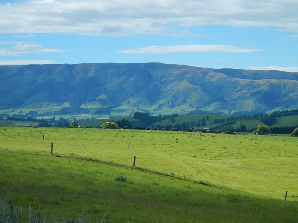
The road that the landlord had said to take took me near to a town called Kyeburn but the track never went into the village as it crossed over the main road just to the west of it. The track was in excellent condition and ran arrow straight parallel to the mountain range away to my right.
The track eventually turned east and infront on me now was the next mountain range that I needed to cross – The Kakanui Mountains.
Once again though I would not be heading over the peak but over the saddle and through Dansey’s Pass.
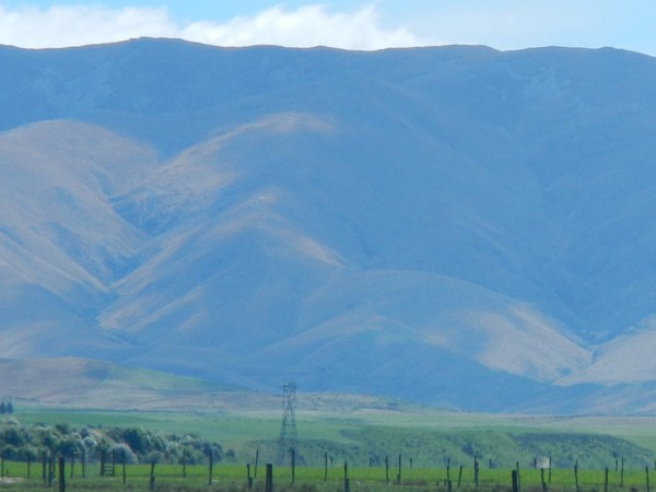
The nearer that I got to the mountain range the more glad I was that I would not be crossing them that day as from this side they looked mightily impressive.
I was now following a river up the valley which more often than not means there will not be any big climbs in the lower parts of the mountains. This river valley was no exception and the road just slowly climbed next to the river.
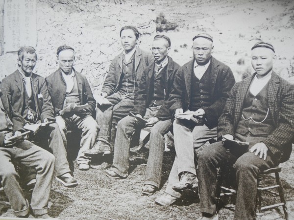
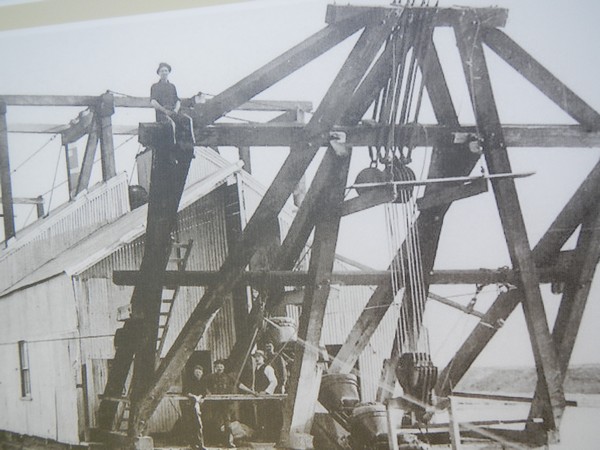
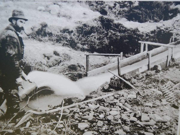
The river led me to an area called Kyeburn Diggings which was the location for a gold rush in 1860.
There were pictures along the way of miners who had come to the area to seek their fortune.
Other pictures showed the different methods that the miners used to try and get to the gold that they thought was in the mountains
It must have been quite a thing to have seen these people trying to find gold in the hills that now surrounded me. The only gold that I would find that day was a pint of golden ale in the pub which lay a few kilometers down the track.
It was just after 2pm when I pulled up to the pub and as the sun was shining I decided to stop and have a beer or two.
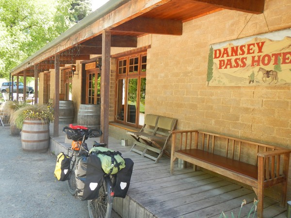
The pub was built in 1862 to cater for the miners who had been attracted to the area by the discovery of gold. Today, instead of serving the miners it now serves the tourist trade that stop in on their way over the pass. It is also seems to be a destination pub for locals who fancy a bit of a drive as when I walked into the pub there were 6 guys from the town of Kurow where I would be heading the following day.
They were very interested in my journey and so I sat with them for a couple of beers before they headed back over the pass.
The pub does not serve food all day and as it was now just after 3pm the lunch service had already finished. The landlady said that she could make me a bacon and egg sandwich if I fancied it and after a couple of beers that sounded like a great plan. I’m not sure if it was the beer or what but the sandwich tasted so good. At 10 NZD though I couldn’t quite let myself have another one even though I could have easily squeezed it in. Instead, I had another pint and thought that I had made a good choice and saved myself 3 NZD in the process.
It was now time to think about getting set up for the night and the landlady said that I could pitch my tent on the lawn outside, but I didn’t fancy sleeping next to the pub as I would have probably just stayed in there all night. So I hopped on my bike and headed 500m up the pass in search of the field that I had been told about.
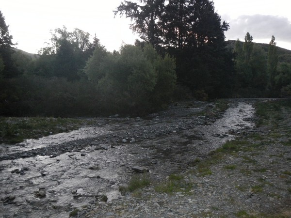
The camping spot turned out to be a grass clearing that was between the pine forest and a stream. An idyllic spot to spend the night.
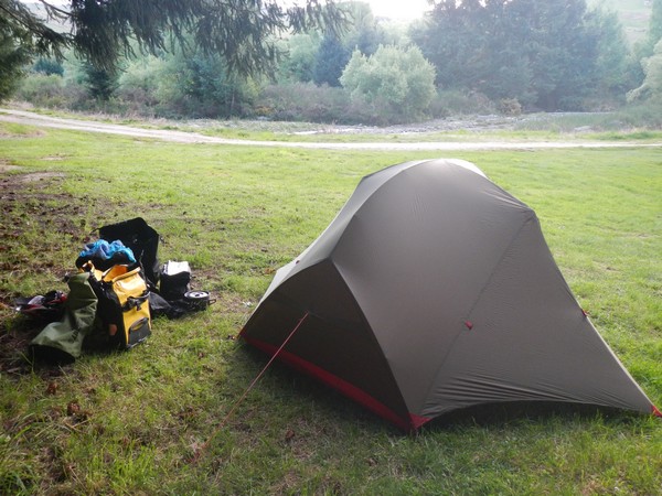
As I was back camping at around 700m the temperature dropped sharply when the sun set and I was soon wrapped up in my sleeping bag with my thermals on.
Here is a video that I shot on my way to Dansey’s Pass:
The pass could wait until tomorrow and the lads at the pub had said there was a winery in Kurow so I think a day off was in order once I got there.
If you would like to automatically receive all future posts straight to your email inbox please just add your details to the form at the foot of this page.